
As we step into a new year, many of us take a moment to set our resolutions—those familiar promises to improve, grow, or change something in our lives. It’s a tradition that brings a sense of fresh beginnings, as we map out the paths we want to take in the months ahead. But what if our resolutions mirrored the paths we travel daily? Roads, like resolutions, are more than just routes to destinations—they represent journeys, obstacles, and progress. This idea is especially true for a road that’s woven deeply into the fabric of the region: Pennsylvania Route 73.
Stretching nearly sixty-three miles across southeastern Pennsylvania, Route 73 connects countless communities, businesses, and lives. One particularly significant stretch, the Skippack Pike, holds a rich history dating back to the early 18th century, offering a glimpse into the region’s growth from colonial days to today’s modern era.
The Skippack Pike, once known as Township Road, is one of the oldest and most historically significant roads in Montgomery County. Established in 1713, it was built to connect German Settlers to Philadelphia and facilitate grain transport to nearby mills. At the time, roads were narrow, unpaved, and often followed ancient Indian trails. When William Penn purchased the land in 1684, settlers began to develop roads to accommodate the region’s rapid growth.
During the American Revolution, the road gained even more importance. After the Battle of Germantown in 1777, General George Washington’s troops camped along the Pike for several days before marching toward Whitemarsh. In 1792, a stone bridge was completed over Skippack Creek—still in use today as the oldest continuously used bridge in the country.
By the mid-19th century, the road had fallen into disrepair. In 1845, the Skippack Turnpike Company was formed to fund its improvement. Though progress was slow, the road was extended and enhanced, eventually becoming known as Skippack Pike. The term “pike” refers to the turnpike system, where a wooden pole, or “pike,” was placed across the road to block passage. Travelers paid a toll for the removal of the pike, allowing them to continue their journey.
Route 73’s full east–west path predates the Interstate and U.S. Highway Systems. It begins at an intersection with Pennsylvania Route 61 in Leesport and runs through Berks County, crossing several key routes before entering Montgomery County. In Boyertown, it meets Pennsylvania Route 562 and continues southeast as Big Road, intersecting Pennsylvania Route 100 before merging with Pennsylvania Route 29. The road follows a picturesque route past towns like Frederick and Zieglerville, before passing through my beloved Schwenksville and on to its final stretch, Skippack Pike, leading toward Philadelphia.

Originally, PA 73 ended at Roosevelt Boulevard (U.S. Route 1) in Northeast Philadelphia. After the completion of the Tacony-Palmyra Bridge in 1929, its terminus moved to the New Jersey state line, where it continues as NJ 73.
While Route 73’s history is largely one of progress, it has also witnessed moments of tragedy. In late 1946, a collision occurred at the intersection of Route 73 and 113, when one car failed to yield at a stop sign, resulting in one fatality and two serious injuries. Another incident took place in late 1954, one mile east of Skippack, when a 35-year-old World War II veteran lost control of his convertible. The car veered off the road, overturned, and pinned him beneath it, killing him instantly.
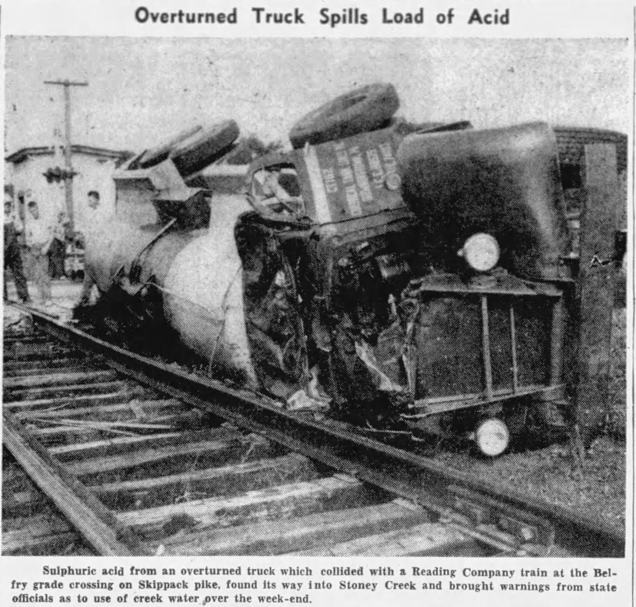
Further incidents marred the road in the decades to come. In 1953, a tanker truck collided with a slow-moving freight train. The overturned tanker, carrying sulfuric acid, blocked the road and halted traffic for more than five hours. One of the train’s three cars derailed, and the acid leaked into nearby Stoney Creek, prompting public warnings about the safety of using the creek water. More recently, in November, a trailer carrying a backhoe flipped and blocked the Pike at the intersection with Bridge Road, causing significant traffic delays for local travelers. These incidents highlight the importance of ongoing infrastructure improvements to keep the road safe for all who travel it.


Today, as you drive along PA 73, you encounter a blend of history and modernity. Colonial-era buildings stand alongside newer commercial developments, reflecting the region’s growth. Sections of the road honor soldiers and law enforcement officers, such as the POW/MIA Memorial Highway in Whitpain Township and the Police Sergeant Stephen Liczbinski Memorial Highway in Northeast Philadelphia.
What makes Route 73 particularly noteworthy is not just its length or geography, but its role in connecting people. It serves as a bridge, both literally and metaphorically, linking communities and offering a route for those seeking opportunities, destinations, or perhaps a fresh start.
As we look ahead to 2025, let us take a moment to reflect on the paths we’ll travel—not just in terms of our personal goals, but also on the paths we share with others. Whether it’s a well-worn route like Route 73 or a new path we’re carving for ourselves, let’s remember that each road—whether familiar or unknown—holds its own stories. Here’s to a happy, healthy, and prosperous 2025.

Leave your thoughts